
The Enduring Power of the Thames: Floods, Controls, and Personal Impact in Ontario
The Thames River, a vital artery winding through Southwestern Ontario, is a beautiful and powerful force of nature. For generations, its presence has shaped the landscape, provided resources, and, at times, unleashed its fury through devastating floods. As someone who has personally experienced the limitations imposed by its floodplains, the history of the Thames’s ebb and flow, and the systems designed to manage it, is more than just an academic interest – it’s a lived reality.
A Legacy of Rising Waters: The Thames’s Flooding History
The Thames River, particularly its North and South Branches that converge in London, has a long and well-documented history of flooding. Early Indigenous communities understood and adapted to these natural cycles, but with European settlement and the development of urban centers, the impact of these events grew significantly.
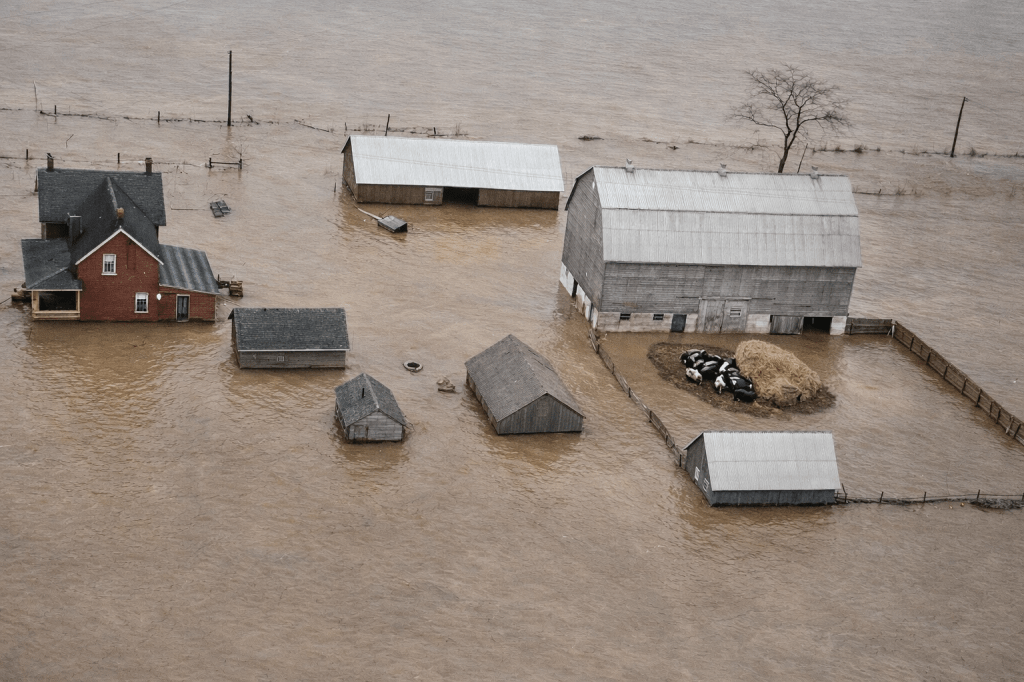
Major floods have scarred the memory of communities along the Thames for centuries. Historical accounts and newspaper archives detail numerous instances of the river overflowing its banks, inundating homes, businesses, and agricultural land. These events, often triggered by heavy rainfall or rapid snowmelt, caused extensive damage and often led to tragic loss of life.
The 1937 flood, for example, remains one of the most significant events in London’s history. The river rose to unprecedented levels, submerging vast areas of the city and causing millions of dollars in damage. The sheer scale of this disaster spurred a greater urgency for comprehensive flood control measures. Other notable floods in subsequent decades, while perhaps not reaching the same catastrophic levels, continued to highlight the Thames’s unpredictable nature and the constant need for vigilance.
The Ripple Effect: Impacts on the Surrounding Area
The effects of Thames River flooding extend far beyond the immediate inundation. Environmentally, floodwaters can scour riverbanks, alter habitats, and transport pollutants. Agriculturally, valuable topsoil can be lost, and crops can be destroyed, impacting the livelihoods of farmers in the rich agricultural lands of the Thames Valley.
Economically, the costs are staggering. Damage to infrastructure – roads, bridges, and utilities – requires massive investment in repairs and rebuilding. Businesses suffer losses due to closures, damaged inventory, and disrupted supply chains. Socially, the emotional toll on residents is immense, with displacement, loss of cherished possessions, and the ongoing stress of living in a flood-prone area.
A System of Control: Managing the Thames’s Fury
To mitigate these impacts, a sophisticated network of flood control and measuring systems has been developed and continually refined across the Thames River watershed. These efforts are primarily spearheaded by conservation authorities, such as the Upper Thames River Conservation Authority (UTRCA) and the Lower Thames Valley Conservation Authority (LTVCA).
Upper Thames Valley Controls:
In the upper reaches of the Thames, particularly upstream of London, several key pieces of infrastructure play a critical role. The Fanshawe Dam
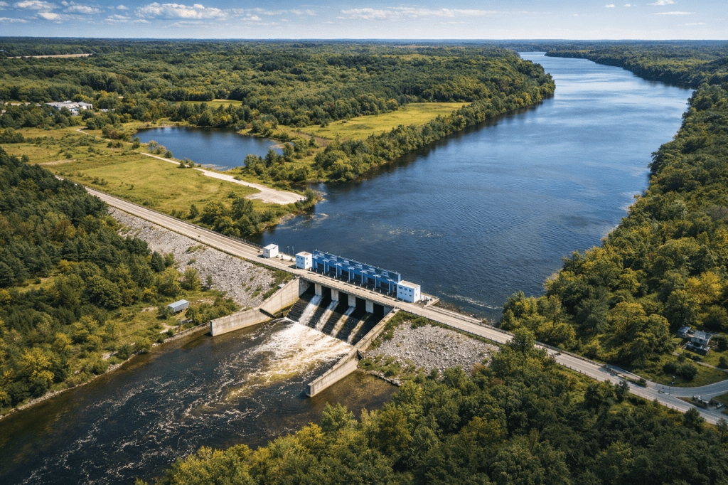
and Pittock Dam
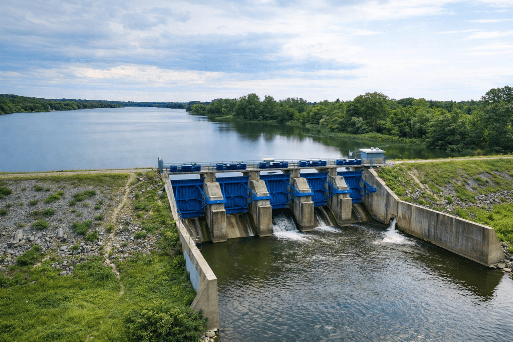
` are prime examples. These large-scale structures are designed to hold back significant volumes of water during peak flows, releasing it gradually to prevent downstream flooding. Their operation is carefully managed based on weather forecasts, snowpack levels, and real-time river conditions.
Complementing these dams are a network of stream gauges
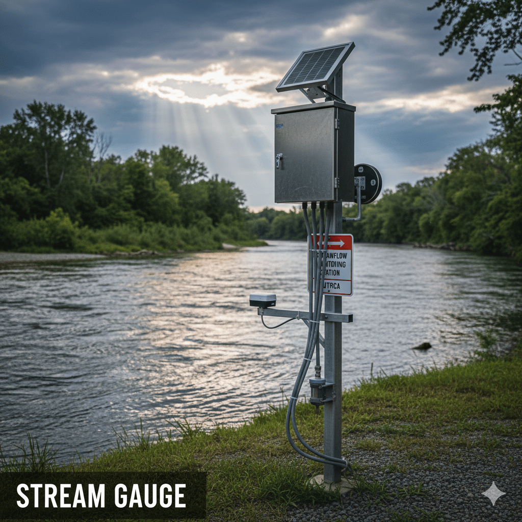
and weather stations
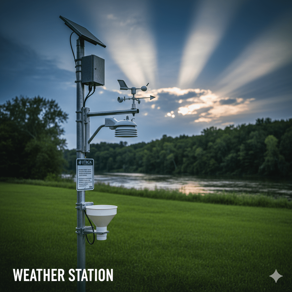
that continuously monitor water levels, flow rates, precipitation, and temperature. This data is crucial for forecasting flood risk and issuing timely warnings to affected communities.
Lower Thames Valley Controls:
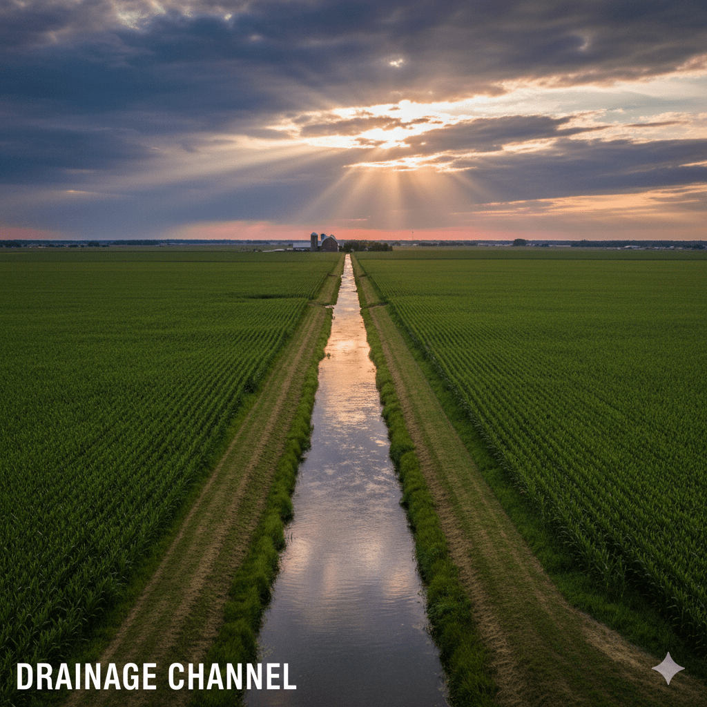
Further downstream, in the Lower Thames Valley, the approach shifts slightly due to the flatter topography and broader floodplains. Here, emphasis is placed on maintaining drainage channels
and implementing dykes and berms

` to protect agricultural land and communities. The LTVCA also utilizes sophisticated hydrological modeling to predict flood extents and depths, allowing for targeted emergency response and land use planning. Throughout the entire watershed, floodplain mapping
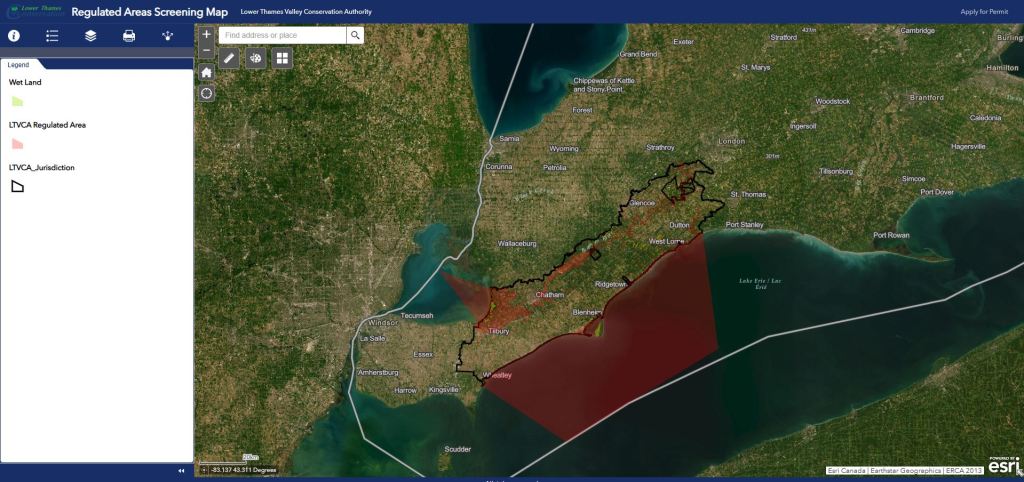
` is a fundamental tool, clearly delineating areas at risk and guiding development decisions.
A Personal Perspective: Living with the Thames’s Limits
While these control systems are vital for public safety and property protection, they also have a direct and often restrictive impact on individuals living within the floodplains. For me, this impact is profound. My rural address, nestled within the beautiful Thames Valley, is designated as being within a flood fringe. This designation, guided by local bylaws such as By-law A1-296, effectively limits my ability to fully utilize my property.
The by-law was designed to prevent new construction in areas prone to flooding. It prevents me from building a NEW house on my land. I can enjoy the natural beauty of the river and the surrounding landscape. However, the dream of constructing a new home tailored to my needs remains out of reach. It’s a constant reminder of the delicate balance between human aspiration and nature’s formidable power. This remains true even when that power is meticulously monitored and managed.
The history of the Thames River flooding demonstrates its untamed nature. It also shows our ongoing efforts to coexist with it. The control systems in place are remarkable feats of engineering and planning. They also highlight the trade-offs inherent in living within such a dynamic environment. For residents like myself, understanding this history and the current management strategies is not just about knowledge. It’s about navigating the very real limitations. These are the opportunities presented by one of Ontario’s most iconic rivers.

Leave a comment