
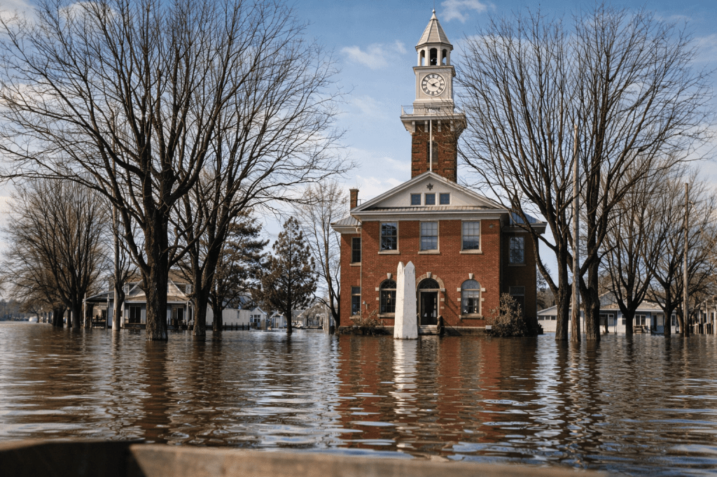
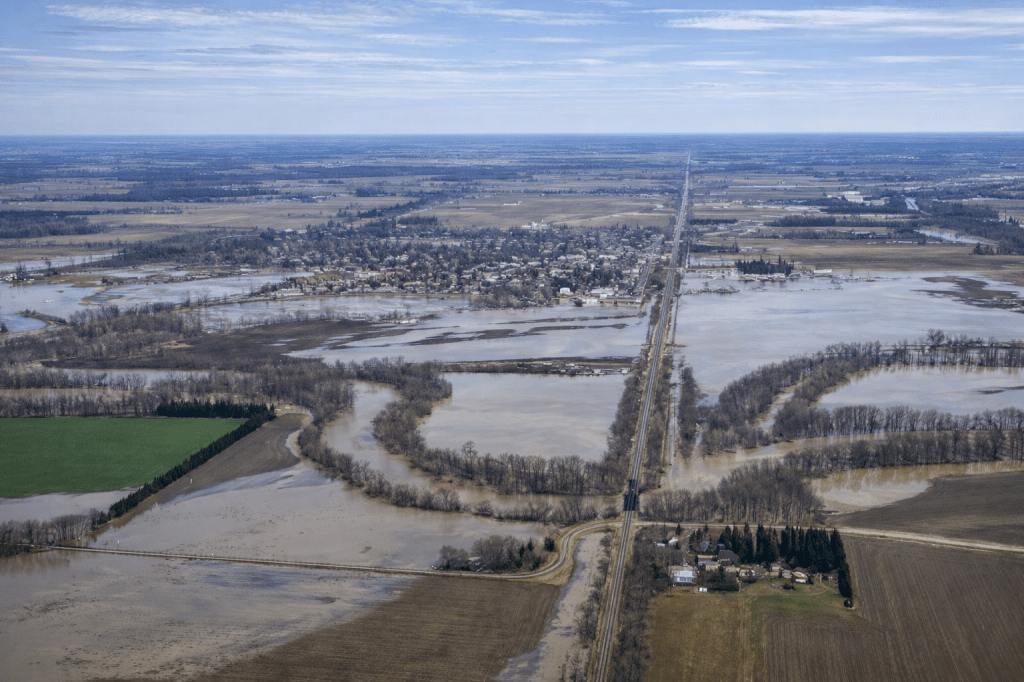
The Thames River is a vital waterway in Southwestern Ontario. It has a history of nourishing the land. It has also caused significant flooding in communities like Thamesville and its surrounding areas. Understanding the frequency, impact, and mitigation strategies is crucial for residents and authorities alike.
A History of High Waters: Documented Flooding Events
While comprehensive records detailing every minor overflow are scarce, several major flooding events have left a lasting mark on the Thamesville area. Here’s a look at some of the most significant occurrences, demonstrating the river’s propensity for high waters:
- 1883: One of the earliest well-documented major floods. Accounts describe widespread inundation.
- 1937: This year saw a particularly severe flood, affecting many communities along the Thames.
- 1947: Another significant flood event, causing considerable damage.
- 1968: A notable spring flood that impacted agricultural land and some residential areas.
- 1989: This event is remembered for its rapid rise in water levels and extensive damage.
- 2008: Heavy rainfall and snowmelt led to widespread flooding in Chatham-Kent, including Thamesville. This event highlighted the vulnerability of infrastructure.
- 2018: The event was not as severe as some past events. However, significant ice jams exacerbated flooding in parts of the Thames River. There were localized impacts in the Thamesville area.
The frequency of significant flooding events in the Thamesville area is notable. In the spring, snowmelt combined with rainfall contributes to this. Major incidents appear to occur roughly every 10-20 years. More minor overflows happen more often.
The Cost of High Waters: Damage and Economic Impact
The financial and social costs of flooding in Thamesville are substantial. Damage costs can be categorized as:
- Property Damage: This includes direct damage to homes, businesses, and public buildings. Basements flooded, structural damage, ruined possessions, and mold remediation can run into hundreds of thousands of dollars per event.
- Agricultural Losses: The fertile lands surrounding Thamesville are heavily agricultural. Flooding can devastate crops, erode topsoil, and damage farm equipment, leading to significant income loss for farmers.
- Infrastructure Damage: Roads, bridges, culverts, and utilities (water, sewer, power) can be damaged. They may become impassable. This disrupts daily life and requires costly repairs.
- Emergency Response Costs: Mobilizing emergency services, setting up temporary shelters, and managing evacuations all incur significant costs for local municipalities.
- Indirect Economic Impact: Business closures, lost wages, and decreased tourism increase the financial burden. A general disruption of economic activity also contributes to the overall financial burden.
Determining precise historical damage cost figures for Thamesville is challenging. However, regional estimates for major Thames River floods often reach tens of millions of dollars. Larger events can reach hundreds of millions across the entire watershed.
Strategies for a Resilient Future: Overcoming Flooding Challenges
Addressing the recurring threat of flooding requires a multi-faceted approach involving infrastructure improvements, land use planning, and community preparedness.
- Dams and Reservoirs: Upstream management strategies, such as the Wildwood Dam near St. Marys and the Pittock Dam near London, play a crucial role. These structures regulate water flow and reduce peak flood levels downstream. Maintaining and potentially optimizing these structures is key.
- Dykes and Levees: In areas particularly prone to inundation, constructing and reinforcing dykes and levees can be essential. These structures provide critical protection to residential and commercial properties. For example, dyke systems exist in parts of Chatham-Kent to protect against both riverine and lake flooding.
- Floodplain Mapping and Regulations: Accurate floodplain mapping helps inform responsible land use planning. Restricting development in high-risk floodplains and implementing stricter building codes for structures within these areas can significantly reduce future damage.
- Wetland Restoration and Naturalized Floodplains: Restoring natural wetlands can help absorb excess water. Allowing certain areas of the floodplain to re-naturalize can slow its flow. This can reduce the impact downstream. These natural sponges are vital components of a healthy watershed.
- Improved Drainage Systems: Regularly maintaining and upgrading municipal storm sewer systems is essential. These actions on drainage ditches can help manage local runoff more effectively. This can prevent localized flooding that can exacerbate river overflows.
- Early Warning Systems and Emergency Preparedness: Robust flood forecasting and early warning systems are essential. These should be coupled with well-rehearsed community emergency plans. This includes clear communication channels, evacuation routes, and accessible resources for residents.
- Individual Property Mitigation: Encourage property owners to implement individual mitigation measures. These include installing backwater valves, elevating utilities, and using flood-resistant building materials. Such actions can significantly reduce personal losses.
- Community Engagement and Education: Educating residents about flood risks, preparedness actions, and available resources fosters a more resilient community.
The Thames River is a precious resource. By understanding its patterns, Thamesville and its surrounding areas can work towards a more resilient future. They can achieve this by investing in proactive measures to become flood-resistant.

Leave a comment