
The Original Silk Road: How Indigenous Trade Networks Shaped Canada
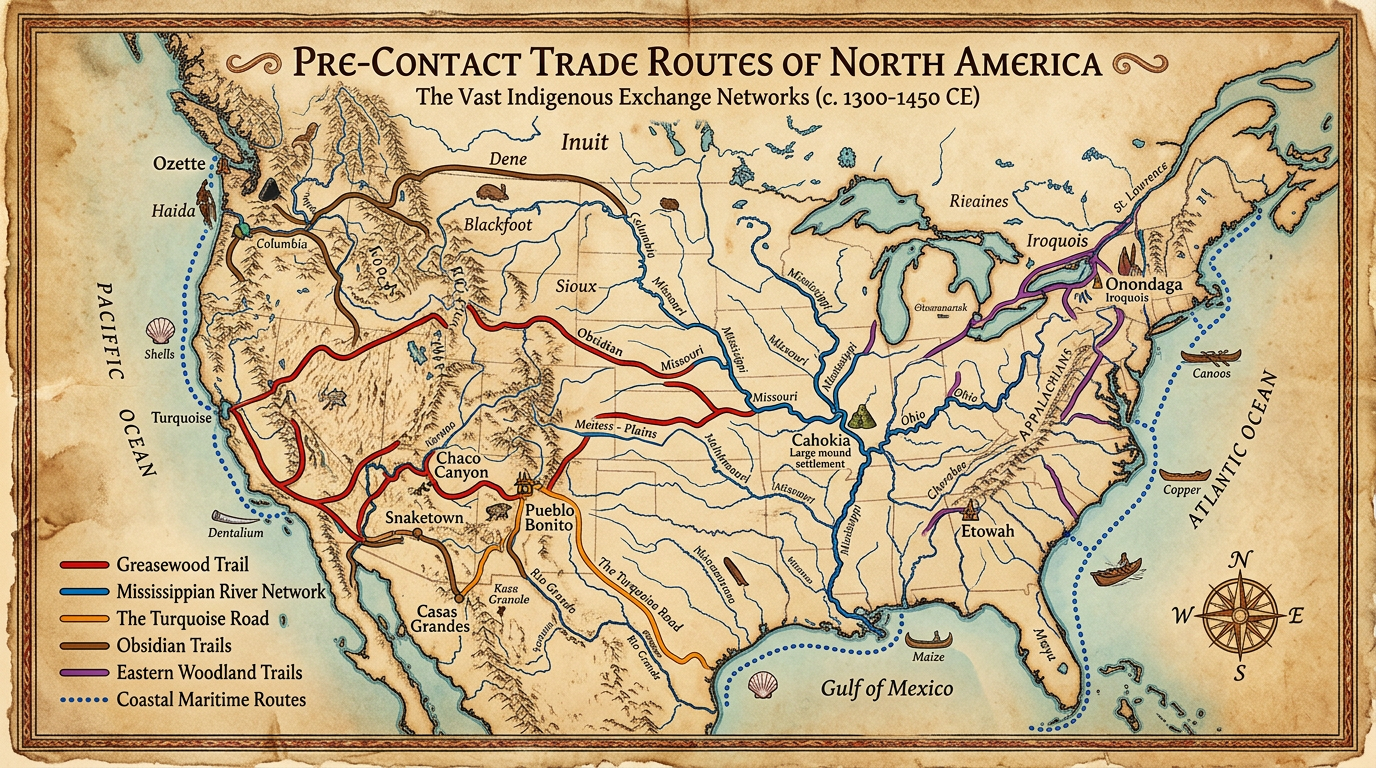
Long before European sails appeared on the horizon, the North American continent was crisscrossed by a sophisticated, continental web of commerce. These weren’t just simple paths through the woods; they were “highways” of exchange that moved goods, languages, and technologies across thousands of kilometers.
To understand modern Canada, one must first understand that the country was built upon the foundations of these ancient Indigenous trade networks.
1. The Geography of Exchange
Indigenous trade routes followed the natural contours of the land—primarily the vast river systems and ancient “grease trails.” These networks connected the Atlantic to the Pacific and the Arctic to the Gulf of Mexico.
- The Great Lakes-St. Lawrence Waterway: This served as a central hub, connecting the agricultural societies of the south (like the Haudenosaunee) with the hunter-gatherer nations of the Canadian Shield (like the Anishinaabe).
- Grease Trails: In the West, specific routes were named after the precious eulachon oil (candlefish fat) traded from the coast to the interior. These trails were so well-established they eventually dictated the paths of modern highways and railways.
2. Primary Goods: More Than Just Survival
Trade wasn’t just about food; it was about status, spiritual significance, and specialized technology.
| Item | Source Region | Significance |
| Copper | Lake Superior | Used for tools and high-status ceremonial items. |
| Obsidian | British Columbia/Rockies | Volcanic glass prized for making incredibly sharp blades. |
| Wampum | Atlantic Coast | Quahog shells used for currency, diplomatic treaties, and oral history. |
| Corn (Maize) | Southern Ontario/Quebec | Traded by Huron-Wendat farmers for Northern furs and dried fish. |
| Oolichan Oil | Pacific Northwest | A high-calorie, nutritious fat essential for interior nations. |
3. The “Middleman” Economy and Diplomacy
Trade was rarely just a transaction; it was a diplomatic event.
The Huron-Wendat Confederacy, for example, became the master brokers of the Northeast. They utilized their strategic location to facilitate trade between the French and various Algonquian-speaking nations.
- Language: Trade led to the development of lingua francas—hybrid languages like Chinook Jargon in the West, which allowed speakers of dozens of different languages to negotiate prices and terms.
- The Great Peace: Trade networks required stability. Elaborate protocols, gift-giving ceremonies, and “smoking the pipe” were essential to ensure that merchants could pass through foreign territories safely.
4. The Arrival of Europeans: A Shift, Not a Start
When European traders arrived, they didn’t “discover” a wilderness; they stepped into a pre-existing, booming market.
Early European survival depended entirely on these networks. The Fur Trade—the economic engine of early Canada—was simply a new layer added to the existing Indigenous system. The Hudson’s Bay Company and the North West Company didn’t forge new paths into the interior; they hired Indigenous guides to lead them along trails that had been used for six millennia.
5. The Lasting Legacy on Modern Canada
The impact of these networks is visible in the very “bones” of Canada today:
- Urban Hubs: Major cities like Winnipeg (a Cree word meaning “muddy waters”) were traditional gathering places where rivers met. These sites were chosen for trade thousands of years before they were chosen for skyscrapers.
- Infrastructure: The Canadian Pacific Railway and the Trans-Canada Highway largely follow the path of least resistance—the same valleys and passes utilized by Indigenous traders for generations.
- Constitutional Roots: The concepts of “Treaty” and nation-to-nation negotiation, which are central to Canadian law, find their origins in the pre-contact diplomatic protocols of trade.
Conclusion
Indigenous trade networks were the first “National Policy.” They proved that the northern half of this continent was not a collection of isolated groups, but a deeply interconnected society capable of moving goods from the Gulf of Mexico to the Hudson Bay. When we look at a map of Canada today, we aren’t just looking at a modern political creation—we are looking at a map etched into the earth by the footsteps of Indigenous traders over thousands of years.
Leave a Reply