
The Ultimate Ontario Road Trip: How Far Can You Drive on Hwy 2, 5, and Dundas Street Without Touching a 400-Series Highway?
If your idea of a perfect road trip involves slowing down, dodging gridlock, and trading concrete sound barriers for historic main streets, you aren’t alone. In Ontario, the 400-series highways (like the 401, 403, and 410) are built for speed—but they completely bypass the soul of the province.
For road trippers who love the journey as much as the destination, three legendary Ontario roads offer an incredible alternative: Highway 2, Highway 5, and Dundas Street.
But how are these roads connected? And more importantly, how far can you actually go across Ontario using this historic corridor without ever merging onto a 400-series highway?
Let’s map out the ultimate non-freeway Ontario road trip.
The Heritage Trio: How Hwy 2, Hwy 5, and Dundas Street Connect
To understand this route, you have to look back at Ontario’s early colonial mapping. Long before the multi-lane 401 cut through the landscape, early settlers and military engineers carved out paths to connect emerging towns.
1. Dundas Street (The Backbone)
Originally conceived by Lieutenant-Governor John Graves Simcoe in the late 18th century, Dundas Street was built as a military transit route. It was designed to connect Lake Ontario to the upper Great Lakes, providing a safe inland passage away from potential American attacks. Today, it remains a massive commercial and commuter artery stretching from the heart of Toronto westward through Mississauga, Oakville, and Burlington (Hertel).
2. Highway 5 (The Western Extension)
As Ontario’s highway system formalised in the 20th century, the provincial portion of Dundas Street running west from Toronto was designated as Highway 5. While much of the eastern section has been downloaded to local municipalities, “Hwy 5” is still used interchangeably with Dundas Street across Halton and Hamilton, leading all the way down to Paris, Ontario.
3. Highway 2 (The Trans-Ontario Pioneer)
Historically, Highway 2 was the granddaddy of Ontario roads. Before the 401 existed, Hwy 2 was the primary highway traversing the entire province, running all the way from the Quebec border in the east, straight through downtown Toronto, and all the way west to Windsor.
Where They Meet
The magic happens just west of Toronto. If you travel west along Dundas Street (Hwy 5) through Mississauga and Waterdown, the road terminates just past Paris, Ontario. From there, a quick shift onto local county roads cleanly links you directly onto historic Highway 2. By combining these three segments, you effectively unlock a continuous, lower-speed pipeline that spans nearly the entire length of Southern Ontario.
The Grand Tour: Mapping the Route Without the 400s
So, just how far can you go? If you play your cards right and stick to this historic corridor, you can drive over 800 kilometres across Ontario, stretching from the Quebec border all the way to the Detroit River in Windsor.
Here is what the journey looks like, broken down from east to west.
Phase 1: The St. Lawrence & Eastern Ontario (Quebec Border to Toronto)
- The Route: Historic Highway 2 (now largely designated as County Road 2 in many regions).
- The Experience: You begin your journey at the Quebec-Ontario border near Lancaster. From here, Hwy 2 hugs the stunning St. Lawrence River. You will glide through historic towns like Cornwall, Brockville, and Gananoque (the gateway to the 1000 Islands).
- The Highlights: You will drive straight through the historic downtown of Kingston—Ontario’s first capital—before tracing the northern shore of Lake Ontario through Belleville, Cobourg, and Port Hope. As you approach the Greater Toronto Area (GTA), the road naturally transitions into Kingston Road through Oshawa and Scarborough.
- The Route: Kingston Road $\rightarrow$ Danforth Ave $\rightarrow$ Bloor St $\rightarrow$ Dundas Street.
- The Experience: This is where the drive shifts from rural bliss to vibrant urban exploration. Following the old paths through Toronto means navigating city traffic, but it rewards you with an unfiltered look at local neighbourhoods.
- The Link: From the east end, you take Danforth Avenue across the Prince Edward Viaduct, connect west via Bloor Street, and angle southwest onto the iconic Dundas Street. Dundas carries you seamlessly across the Etobicoke Creek boundary and straight through Mississauga (AECOM Canada Limited).
Phase 3: The Niagara Escarpment & Western Plains (Burlington to Paris)
- The Route: Highway 5 (Dundas Street).
- The Experience: Leaving the dense urban core, Highway 5 begins to climb. You will ascend the breathtaking Niagara Escarpment near Waterdown, enjoying sweeping views of the Hamilton area.
- The Highlights: The road rolls through rural Flamborough and past beautiful conservation areas before dropping down into the charming, cobblestone-laden town of Paris, Ontario, where the Grand and Nith rivers meet.
Phase 4: The Deep Southwest (Paris to Windsor)
- The Route: Transition back to Highway 2.
- The Experience: Just west of Paris, Highway 5 hands the baton back over to Highway 2. From here, you enter Ontario’s agricultural heartland.
- The Highlights: You will cruise at a comfortable 80 km/h through Woodstock, London, Chatham, and directly into Windsor, terminating right at the edge of the Detroit River.
Why Ditch the 400-Series Highways?
Opting out of the 400-series network isn’t just about avoiding the aggressive trucks and white-knuckle merging of the 401. It completely changes the dynamic of your trip.
| Factor | 400-Series Highways | The Hwy 2 / 5 / Dundas Route |
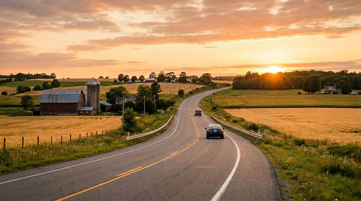
| Pace & Atmosphere | High-stress, fast-paced (100–120+ km/h), generic concrete barriers. | Relaxed (50–80 km/h), scenic farmland, and historic architecture. |
| Local Culture | Fast food rest stops and gas stations at identical off-ramps. | Local bakeries, independent coffee shops, and Ontario heritage plaques. |
| Scenery | Flat, cleared paths designed purely for utility. | Waterfront views along the St. Lawrence, escarpment cliffs, and river valleys. |
Essential Tips for Your Non-400 Journey
Before you pack your bags and head out on this epic cross-province crawl, keep a few things in mind to ensure a smooth ride:
- Watch for “Highway Downloading”: In the late 1990s, the Ontario government transferred ownership of many secondary highways to local counties. Because of this, look closely at your maps: Highway 2 is frequently signed as “County Road 2” or “Regional Road 2,” while Highway 5 transforms into “Halton Regional Road 5” in certain municipalities.
- Embrace the Traffic Lights: Driving through places like Mississauga or downtown Toronto via Dundas Street means you will encounter stop-and-go commuter traffic (Srivastava). If you are looking to cross the GTA quickly, budget extra time, or plan your drive for early Sunday morning when the city is still asleep.
- Plan Local Pitstops: The absolute best part of this route is the ability to pull over on a whim. Make time to visit the local boutiques in downtown Brockville, grab lunch by the river in Paris, or take a lakeside stroll in Cobourg.
The Verdict: Just How Far Can You Go?
The answer is simple: You can travel the entire length of settled Southern Ontario.
By threading together Highway 2, Highway 5, and Dundas Street, you can successfully drive from the borders of Quebec all the way to the United States—roughly 850 kilometres—without ever spinning your wheels on a 400-series freeway. It is a masterclass in slow travel, offering a window into Ontario’s rich history, diverse ecosystems, and vibrant local communities.
So turn off the GPS highway routing, roll down the windows, and go explore Ontario the way it was originally meant to be seen.
References
- AECOM Canada Limited. (2022). Environmental Project Report – Dundas Bus Rapid Transit Mississauga East. Metrolinx. https://assets.metrolinx.com/image/upload/v1663151576/Documents/Metrolinx/dundas_brt_mississauga_east_environmental_project_report_march_28_wf02i9.pdf
- Hertel, S. (n.d.). EQUITY – Metrolinx. Metrolinx / City of Mississauga. https://assets.metrolinx.com/image/upload/v1663240159/Documents/Metrolinx/Next_Stop_Equity_Routes_to_fairer_transit_access_in_the_GTHA.pdf
- Srivastava, L. (2015). Exploring the benefits of traffic pricing in Toronto and the GTA. Pembina Institute. https://www.pembina.org/reports/fare-driving.pdf
Leave a Reply