
The History of Canada’s Settlement Patterns and Why Most Canadians Live Where They Do Today
Canada is the second-largest country on Earth, stretching from the Atlantic Ocean to the Pacific Ocean and northward into the Arctic. Yet despite its immense size, the vast majority of Canadians live within a relatively short distance of the United States border. This unique population pattern did not occur by accident. It was shaped by geography, climate, transportation, immigration policies, land grants, farming opportunities, and government decisions spanning more than four centuries.
To understand modern Canada, one must first understand how the land was explored, divided, settled, farmed, and developed.
Before European Settlement
Long before European explorers arrived, Indigenous peoples occupied every region of what is now Canada. First Nations, Inuit, and Métis communities developed extensive trade networks, transportation routes, agricultural systems, and governance structures adapted to Canada’s varied environments.
European settlement was built upon lands already inhabited by Indigenous peoples. Throughout the 18th and 19th centuries, treaties, land purchases, and in many cases the displacement of Indigenous populations opened vast areas to colonial settlement. This process remains one of the most significant and debated aspects of Canadian history today.
The First European Settlements
The earliest permanent European settlements in Canada were established by the French.
In 1604, French settlers established Port Royal in Acadia, located in present-day Nova Scotia. Four years later, Samuel de Champlain founded Quebec City along the St. Lawrence River, creating what would become the heart of New France. The St. Lawrence River quickly became Canada’s first transportation corridor and remains one of the most important geographic features in the country’s development.
Settlements naturally clustered around:
- Navigable waterways
- Good agricultural land
- Fishing grounds
- Fur trading routes
- Defensive positions
At the time, forests covered much of eastern Canada, making rivers the equivalent of modern highways.
Why Canada Developed Along the Border
One of the most common questions about Canada is why so many Canadians live near the American border.
The answer is surprisingly simple:
Climate
Southern Canada has the country’s longest growing season, most fertile farmland, and mildest temperatures.
Transportation
The Great Lakes and St. Lawrence River created natural transportation corridors that allowed goods and people to move efficiently.
Agriculture
Early settlers depended on farming for survival. The best agricultural land existed primarily in southern Ontario, southern Quebec, and later the Prairie provinces.
Trade
The United States became Canada’s largest trading partner. Communities near the border gained easier access to markets and transportation routes.
Today, nearly 90 percent of Canadians live within approximately 200 kilometres of the U.S. border because the factors that drove settlement centuries ago continue to influence where people choose to live and work.
How Land Was Surveyed and Divided
One of the greatest challenges facing early governments was determining who owned what land.
The Seigneurial System
In New France, land was divided into long, narrow strips extending back from rivers.
This system ensured that every landowner had access to water transportation. Even today, the pattern can be seen from the air along parts of the St. Lawrence River.
Township Surveys
After Britain gained control of much of Canada, surveyors increasingly adopted square township systems.
Ontario became organized into concessions and lots.
Roads were laid out in grid patterns.
A typical township contained:
- Concessions running parallel
- Lots ranging from 50 to 200 acres
- Road allowances between concessions
Many modern rural roads in Ontario still follow these original survey lines.
The Dominion Lands Survey
Perhaps the most ambitious land division system in Canadian history was the Dominion Lands Survey, created after Confederation.
Following the Dominion Lands Act of 1872, western Canada was divided into an enormous grid of townships and sections. Settlers could acquire a quarter-section, typically 160 acres, by meeting residency and cultivation requirements.
This survey system still defines much of:
- Manitoba
- Saskatchewan
- Alberta
- Parts of British Columbia
Drive across the Prairies today and the straight roads and square fields are direct results of this 19th-century survey system.
How Immigration Built Canada
Immigration was essential to Canada’s growth.
The federal government actively recruited settlers from Europe and the United States to populate the country.
Major immigration waves included:
French Colonists
1600s to 1700s
Settled primarily in Quebec and Acadia.
Loyalists
Late 1700s
Thousands of Loyalists fled the American Revolution and settled in Ontario, New Brunswick, and Nova Scotia.
British and Irish Immigration
1800s
Large numbers arrived seeking land and opportunity.
Many Irish immigrants entered Canada during and after the Great Famine.
Prairie Immigration Boom
1896–1914
The federal government aggressively promoted western settlement.
Millions of immigrants arrived from:
- Ukraine
- Germany
- Poland
- Scandinavia
- Britain
- Eastern Europe
- The United States
Many were attracted by promises of inexpensive or free farmland under the Dominion Lands Act.
Where Immigrants Arrived
Before air travel, nearly all immigrants arrived by ship.
Major entry ports included:
Quebec City
The primary gateway to central Canada during much of the 19th century.
Halifax
One of Canada’s most famous immigration ports.
Saint John
An important Atlantic immigration centre.
These ports processed hundreds of thousands of newcomers before they travelled inland by river, rail, wagon, or road.
Later, Halifax’s Pier 21 became known as Canada’s “Gateway to the Nation.”
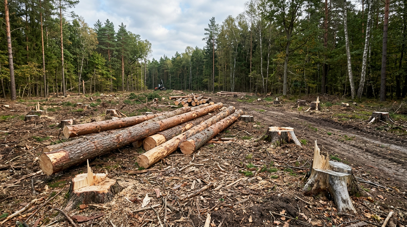
Clearing the Land
When settlers received land, they rarely found open fields waiting for cultivation.
Instead, they encountered dense forests.
Land clearing became one of the hardest tasks facing pioneer families.
Methods included:
Axes and Crosscut Saws
The primary tools of early settlement.
Families spent years removing trees.
Stump Removal
Even after trees were cut, roots remained.
Farmers used:
- Horses
- Oxen
- Chains
- Hand tools
- Dynamite
Burning
Brush and timber were often piled into enormous burn heaps.
Smoke from land clearing became a common sight across early Canada.
Many settlers spent decades transforming forest into productive farmland.
A farm that appears naturally open today often represents generations of labour.
How Hamlets Became Cities
Most communities followed a remarkably similar pattern.
Stage 1: Homestead
A single family establishes a farm.
Stage 2: Settlement Cluster
Several farms develop nearby.
Stage 3: Hamlet
Essential services appear:
- Blacksmith
- General store
- Church
- School
Stage 4: Village
Population grows.
Businesses expand.
Roads improve.
Stage 5: Town
Municipal government forms.
Industry develops.
Railways arrive.
Stage 6: City
Economic diversification creates sustained growth.
Examples include:
- Toronto
- Winnipeg
- Calgary
- Edmonton
- Saskatoon
- Regina
Nearly every major Canadian city began as a small settlement serving nearby farms.
How Homes Were Built
Log Cabins
The first homes were often built from trees harvested directly on the property.
Construction was simple:
- Hand-hewn logs
- Clay chinking
- Stone foundations
Timber Frame Construction
As communities grew, more sophisticated structures appeared.
Heavy timber frames allowed larger buildings and barns.
Balloon Framing
In the late 1800s, dimensional lumber and nails became more available.
Balloon framing dramatically sped up construction.
Platform Framing
The modern construction method evolved from earlier framing techniques.
Today most Canadian homes use engineered lumber, manufactured components, insulation systems, and advanced building codes.
Modern homes are significantly more energy-efficient but also vastly more expensive to build.
The Rural Way of Life
For much of Canadian history, self-sufficiency was normal.
Families often:
- Grew their own food
- Raised livestock
- Cut firewood
- Built outbuildings
- Repaired equipment
- Produced much of what they consumed
Cash income was often secondary to survival.
Communities relied heavily on neighbours through barn raisings, harvest assistance, and shared labour.
This rural culture helped build much of Canada.
Why the Old Way of Life Is Becoming More Difficult
Many Canadians today feel that recreating the lifestyle enjoyed by earlier generations has become increasingly challenging.
Several factors contribute to this perception.
Rising Land Prices
Agricultural and rural land values have risen dramatically in many regions.
Land that once supported family farms is increasingly viewed as an investment asset.
Increasing Construction Costs
Modern building codes require:
- Engineering
- Permits
- Inspections
- Energy efficiency standards
While these requirements improve safety and performance, they also increase costs.
Higher Material Prices
Building materials have experienced substantial price increases over recent decades.
Even modest homes require significant financial investment.
Property Taxes and Development Charges
Municipal taxes, fees, and development charges can add substantial costs to home ownership and construction.
Regulatory Requirements
Environmental regulations, zoning rules, and permitting processes have become more complex than those faced by earlier generations.
Supporters argue these measures protect public safety and environmental quality.
Critics argue they can create barriers for individuals seeking affordable rural lifestyles.
Property Valuations
Many rural property owners have seen assessed values rise substantially.
Higher valuations often translate into increased taxation and ownership costs, even when incomes have not increased proportionally.
The Canada We Inherited
Modern Canada was shaped by countless settlers who arrived through Atlantic ports, travelled inland along rivers and railways, cleared forests, broke prairie sod, built homes, established farms, and created communities from scratch.
The hamlets they founded became villages.
The villages became towns.


The towns became cities.
The transportation routes they followed became highways.
The fields they cleared continue to feed millions.
Understanding how Canada was settled helps explain why Canadians live where they do today, why communities developed in certain regions, and why rural life remains deeply woven into the country’s identity.
While technology, government policy, and economic conditions have transformed daily life, the foundations of modern Canada remain rooted in the determination, sacrifice, and resilience of those who first turned wilderness into communities and communities into a nation.
Sources
- Government of Canada – Discover Canada: Canada’s History
- Canadian Museum of Immigration at Pier 21 – Settling the West
- The Canadian Encyclopedia – Dominion Lands Policy
- Natural Resources Canada – Territorial Evolution of Canada
Leave a Reply